Karaburun
Karaburun region is comparatively much less visited than Çeşme located in its south, its rate of urbanization at 20 per cent is the lowest across İzmir Province, although it provides an anticlimax to its southern neighbor and the associated attractions especially for those who want to escape the trails of mass tourism. The coasts of the peninsula have beautiful bays and pebble or sand beaches as yet often undiscovered by outsiders, although there is one German vacation village slightly to the north of the district center. Taken as a whole, in contrast with Çeşme, agriculture, fishing and livestock breeding, instead of tourism, remain the principal activities on which the district's economy is based. Karaburun's flora and fauna present particularities distinguishing it from the Anatolian mainland. Karaburun's name echoes in Turkey a very high variety of flower breeds present across its area, and especially narcissus and hyacinth.
The distance between Karaburun and İzmir center by way of land is 100 km (approximately 60 miles) and there are regular bus services and a three-lane modern highway until the toll near Çeşme. The rest of the road is narrow and curvy in some places and it may take up to two hours to reach Karaburun from İzmir. The country road is traced northwards along the eastern coast of the peninsula to reach Mordoğan first, which is, aside from Karaburun, the district's only other depending township with own municipality. After Karaburun, the same road continues towards the tip of the peninsula from where it heads west to reach the village of Küçükbahçe.
Map - Karaburun
Map
Country - Turkey
 |
|
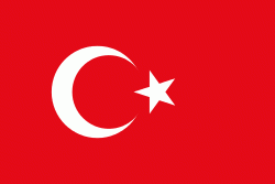
| Flag of Turkey | |
One of the world's earliest permanently settled regions, present-day Turkey was home to important Neolithic sites like Göbekli Tepe, and was inhabited by ancient civilisations including the Hattians, Hittites, Anatolian peoples, Mycenaean Greeks, Persians and others. Following the conquests of Alexander the Great which started the Hellenistic period, most of the ancient regions in modern Turkey were culturally Hellenised, which continued during the Byzantine era. The Seljuk Turks began migrating in the 11th century, and the Sultanate of Rum ruled Anatolia until the Mongol invasion in 1243, when it disintegrated into small Turkish principalities. Beginning in the late 13th century, the Ottomans united the principalities and conquered the Balkans, and the Turkification of Anatolia increased during the Ottoman period. After Mehmed II conquered Constantinople (Istanbul) in 1453, Ottoman expansion continued under Selim I. During the reign of Suleiman the Magnificent, the Ottoman Empire became a global power. From the late 18th century onwards, the empire's power declined with a gradual loss of territories. Mahmud II started a period of modernisation in the early 19th century. The Young Turk Revolution of 1908 restricted the authority of the Sultan and restored the Ottoman Parliament after a 30-year suspension, ushering the empire into a multi-party period. The 1913 coup d'état put the country under the control of the Three Pashas, who facilitated the Empire's entry into World War I as part of the Central Powers in 1914. During the war, the Ottoman government committed genocides against its Armenian, Greek and Assyrian subjects. After its defeat in the war, the Ottoman Empire was partitioned.
Currency / Language
| ISO | Currency | Symbol | Significant figures |
|---|---|---|---|
| TRY | Turkish lira | ₺ | 2 |
| ISO | Language |
|---|---|
| AV | Avar language |
| AZ | Azerbaijani language |
| KU | Kurdish language |
| TR | Turkish language |


